

Update for 2024:
Yosemite National Park will once again require reservations for visitors arriving by car as part of a new pilot program to manage visitation at the park.
World → N America → Sierra Nevada → John Muir
Click PLAY or watch a 1-minute introduction on YouTube.
One of the best hikes in the world is the
John Muir Trail
Hikes in this area are called:
- Mount Whitney Trail
- Half Dome (Cable Route permit required since 2011)
- … many, many more
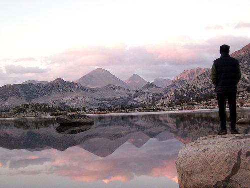
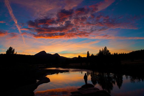
Walk for 2-3 weeks without crossing a road. Brilliant! This is the best hike in the USA and includes many of the best sections of the longer Pacific Crest Trail.
AT A GLANCE
- one of our top 10 hikes in the world
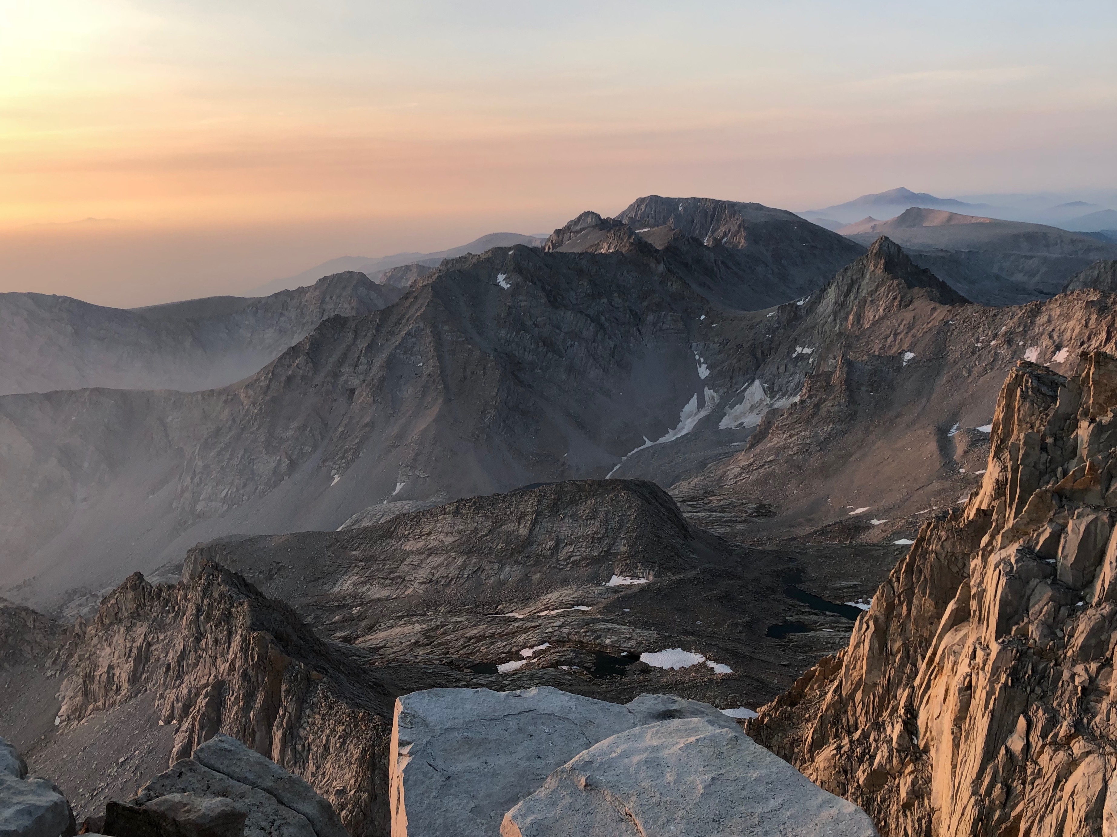
- start in stunning Yosemite, continue south through Muir’s “Range of Light”, the Sierra Nevada
- 223mi (360km) to Whitney Portal adding sidetrips to Half Dome (with permit), Vermillion Valley Resort and Mt. Whitney 14,505ft (4,421m)
- 15-21 days recommended
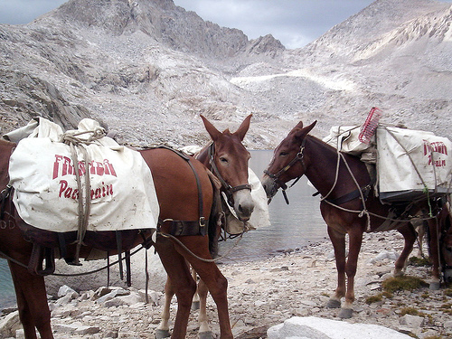
- most hikers carry their own food and tent (pack animals can be hired, however)
- most hikers resupply en route
- anyone can walk sections, but to do the John Muir as a thru-hike requires experience, toughness and advance planning.
- short hiking season as snow still covers some passes into July and some passes may be snowed in as early as mid-Sept.
- the best weeks are Aug through early Sept.
- getting a permit to start in Yosemite or Whitney is difficult — apply 24wks in advance.
- easy to difficult hiking, depending on weather and trail conditions
- temperatures can range from 86F+ (30C) to below freezing
- bear-proof food containers mandatory
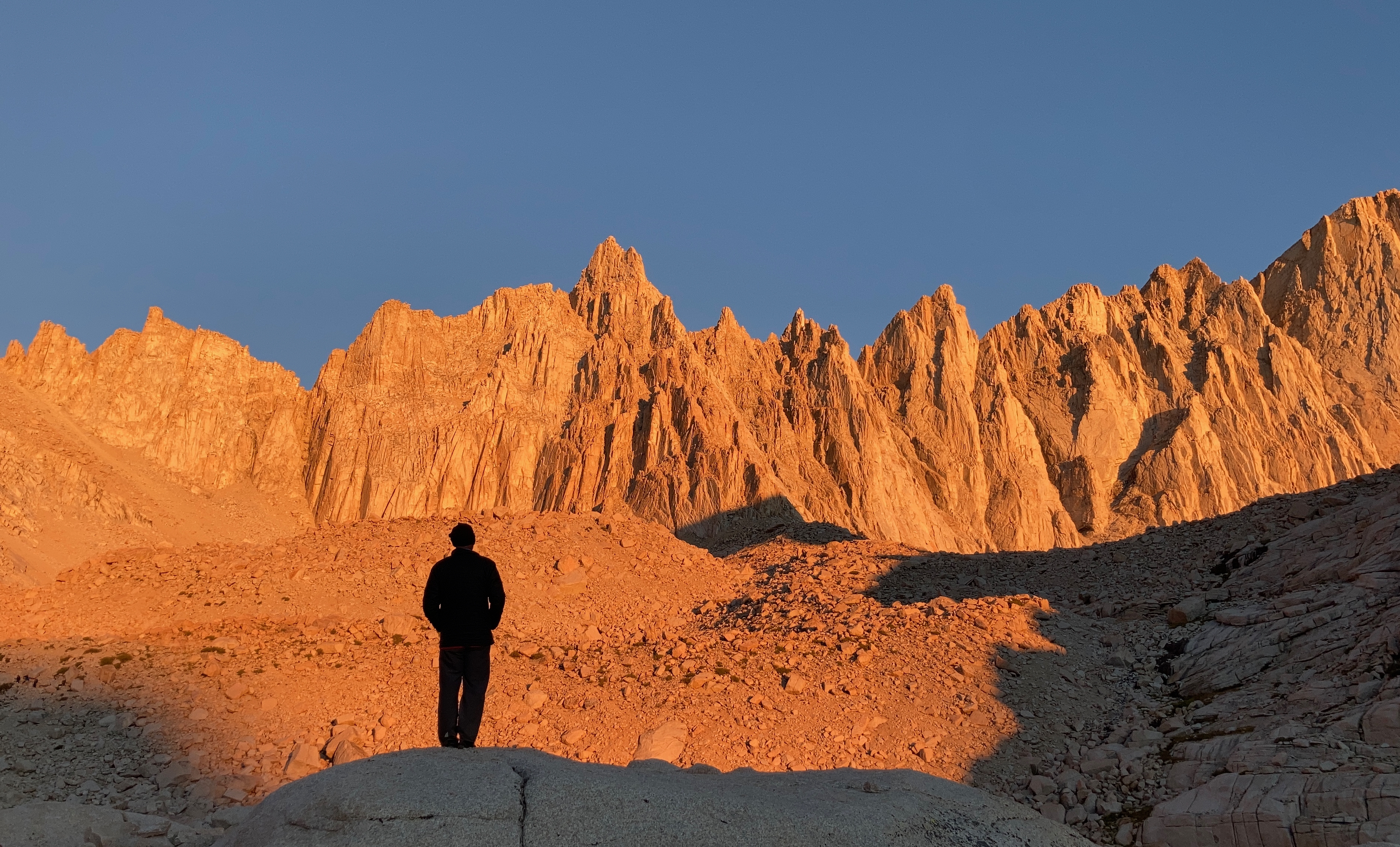
Whitney is the highest mountain in the lower 48, and the most climbed.

Why We Like This Hike
For many, this is the best hike in the world. More than that, it’s a pilgrimage in honour of the man who co-founded the Sierra Club and helped create Yosemite National Park.
-
- crosses Yosemite, Ansel Adams and John Muir wilderness, Kings Canyon and Sequoia National Parks
- 11 high passes, unbelievable views
- about 10 Ranger stations en route
-
- comparatively safe walking for such a long hike (the scramble up Half Dome being the notable exception)
- JMT is almost 10% the length of the Pacific Crest Trail
- many marvellous waterfalls cascading huge granite walls
- thousands of small lakes
- public transport to the trailheads (easy to Yosemite, Reds, Bishop, Lone Pine and others)
- the JMT passes through 6 of 7 ecological zones of America
- gorgeous “wild camping” options. No need to tent near other people unless you wish to.

- great weather — though afternoon summer thunderstorms are frequent
- Whitney, highest in the continental USA, is a beautiful and impressive peak
- the warm welcome (and day off) at Vermillion Valley Resort is a highlight
- the Wilderness Permit is free
- it is easy to solo the JMT — but only if you are strong enough to haul your own gear. In fact, there are many solo hikers, including solo female hikers.
- signing the summit register on Whitney is a great culmination to the adventure
Considerations
A survey of more than 700 John Muir Trail thru-hikers gave researchers insight into what makes a hiker more likely to get injured or ill. Surprisingly, young over-enthusiastic hikers are at greater risk than the grey beards. 😀
- younger age
- higher BMI (body mass index)
- higher BPW (base pack weight)
A 2014 survey identified the most frequent problems reported by hikers:
- blisters (57 percent)
- sleep problems (57 percent)
- pack strap pain (46 percent)
- knee/ankle pain (44 percent)
- back/hip pain (43 percent).
- 37 percent reported altitude sickness.
A big problem when planning the JMT is that Muir Trail Ranch is the last place you can easily resupply with food. From there you may need to carry 10 days food or more over steep, remote passes to Whitney. (Consider finishing at the Ranch or Reds if you do not think you are up to the remote southern section of the JMT.)
An alternative is to arrange for someone to bring you food / fuel on the trail.
Also, on the Muir Ranch to Whitney section you may need carry more food than you can fit in one bear canister (barrel).
- not many bear-proof campground lockers are available on the JMT. You need and are required to carry a bear-proof food container.
- water is not a major problem, but it will be dry on the the high passes in August
- treating water is recommended
- dehydration and heat are more often problems than hypothermia, but bring enough warm clothes for cold mornings at altitude
- bring a lightweight stove. Campfires are restricted based on elevation.
- the smartest bears in the world will be trying to get anything edible or that smells edible
- Marmots will eat anything and may chew through your pack. We even had a chipmunk chew through our tent on Whitney, attracted by some batteries wrapped in plastic.
- mosquitos are a problem early in the season
- keeping with rustic tradition, the JMT has very few signs. It’s fairly easy to get lost as (We did in 2007.)
- altitude sickness is a big worry, if you are starting at Whitney
- some hikers bring DIAMOX (Acetazolamide) — we do not recommend it
- Half Dome cables are taken down early to mid-October
- the YARTS bus used by some hikers is seasonal — running June 15 to October 15 in 2021
- you must poop in a bag on Whitney. (If you’ve never done it, you are in for an experience.)
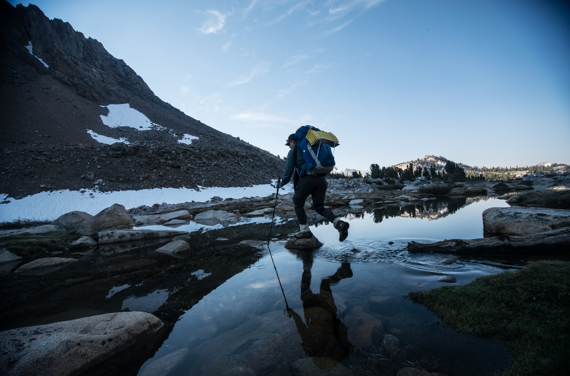
- some river crossings may be a concern early in the season. Hiking poles an advantage.
- Most hikers prefer sturdy footwear on this trek. A second pair of footwear is recommended for around camp and for creek crossings
- there is limited parking at Whitney Portal on a busy day
- you are not supposed to leave food in the vehicle at Whitney Portal (due to bears) but there are not enough bear lockers to accommodate everyone.

Cost
- this is one inexpensive holiday, all things considered
- bear canisters can be rented in Yosemite, but you might be better off buying your own.
Routes

- the recommended route starts in Yosemite and culminates with an ascent of Mt. Whitney, the highest point in the lower 48. You are well acclimatized to altitude by the time you get there!

- the main downside of starting in Yosemite at Happy Isles trailhead is the steep climb at the start of your hike. Smart hikers, instead, catch the Tuolumne Meadows Tour bus from Yosemite valley up to Tuolumne Meadows, then hike back down to Yosemite via Half Dome. (Turning the slog into an easier descent.) From there take the shuttle again back up to Tuolumne Meadows where you resupply and start the trail proper. (Credit for this idea goes to one of the comic Yosemite shuttle drivers who went on to tell us that thru-hikers are mostly crazy — they consider this cheating.)
- You can certainly reverse the route and start from Whitney Portal at 8,360ft (2548m). Public transport is more easily available out of Yosemite, for one thing. But you risk ill effects from the huge altitude gain of 6100ft (1859m) right at the start of your long trip while your pack is heavy. This is a particularly bad idea if you are coming from sea level. Not only that, but it may take you 10 days to get to the next resupply at John Muir Ranch. With a full pack. Over the highest passes.
- the main advantage of hiking south to north is that it puts the sun at your back (rather than in your eyes) for most of the day
- Almost everyone should hike south towards Whitney.
- Cicerone – The John Muir Trail by Alan Castle lays out the JMT into 21 day long stages. Start with that reasonable itinerary. Hard core hikers often finish in 15 days. Some have taken as long as 30 days.
- John Muir Trail by Elizabeth Wenk uses drainage basins to split up the JMT. This guidebook worked well for us. Get the most recent edition.
- for those flying, the most popular access airport is San Francisco
- from there, not surprisingly, public transport to Merced, California is convenient by bus or train. Merced (pop. 60,000) is the last good place to buy your food.
- from Merced we took the popular YARTS bus to Yosemite. If you need to overnight anywhere en route, choose Yosemite Bug lodge and hostel, a gem of a location and inexpensive. Right by a YARTS bus stop.
- an alternative we used in 2021 was to fly into Reno. Bus to Mammoth. YARTS to Tuolumne.
- Once you have a Backpacking permit, you are allowed to camp in Yosemite at the Backpackers Camp
- exiting the trail at Whitney Portal is problematic. On any given day you will see tired, dirty hikers trying to find a ride down to the town of Lone Pine.
- best is to have someone pick you up there in a personal vehicle. You may have to telephone them once you arrive at the famed trailhead store restaurant. (Giant pancakes, great burgers!)
- public transport IS available from the small tourist town of Lone Pine, California on the doorstep of the Mojave desert. That’s 13mi (21km) east of the Whitney Portal trailhead.
- there are at least a dozen hotels and motels in Lone Pine and a number of campgrounds on the way up to the mountains. If camping, however, try to stay at the Whitney Portal Family Campground and spend time at the Whitney Portal trailhead store.
- in Lone Pine we try to stay at the Whitney Portal Hostel
- From Lone Pine, your best, perhaps only, option out is the Eastern Sierra Transit Bus on US-395. That is not a busy highway. Confirm what’s running, when.
- you might be able to hire transport trailhead <> Lone Pine (but don’t count on it as shuttles are often booked during high season).
- Inyo Mono Transit (760) 872-1901
- Kountry Korners, Bishop, CA, (877) 656-0756
- Walt’s Inyo Trailhead Transportation, Lone Pine, CA, (760) 876-0035

Trekking Guides
Most hikers do the JMT on their own, but you may be able to hire a guide or join a hiking group. A few options to consider:
- Sierra Mountain Center
- World Expeditions ($4700 in 2021)
- Mountain Travel Sobek
- Southern Yosemite Mountain Guides
- Call of the Wild – Yosemite High Country Hiking
- … leave a comment if you have a guide to recommend
Logistics
If you sign on with a guided trip, logistics will be organized for you. This section is for independent hikers.
Most critical is getting your JMT permits.

For 2018 only 2% of applicants for southbound JMT permits were successful. Consider doing it northbound, instead, taking time to acclimatize to altitude at the start. That permit is easier to get.
NOTE: Those with Pacific Crest Trail permits for 500 miles or longer do most of the JMT as those two trails are one and the same for parts of the Sierra Nevada.
This information page is far too short to explain all you need to plan a JMT hike. We just give an overview and point to the best resources.
Yosemite permits are available 24 weeks (168 days) in advance. But you should get a guidebook and start researching your options long before that. There are many ways to section hike parts of the JMT without having permits for the entire routes.
Whitney is the toughest permit. On the other hands, it’s a short side trip from the JMT.
- JohnMuirTrail.org – permits
- reservations for lodging and campgrounds
- ideally you get someone with a personal vehicle to move you and to drop food caches. Without wheels, it is tricky (not impossible) to organize this trip.
- There are four popular places to resupply on the trail including Tuolumne Meadows, Red’s Meadow, VVR and the Muir Trail Ranch.
- most recommended, however, is Vermilion Valley Resort which caters to thru-hikers and is only one mile and a short ferry ride off the JMT. Take a rest day there if you have the time.
- Needless to say, you should plan and confirm your food drops well in advance with the direction of a guidebook and PCTA.org. This can be your biggest JMT hassle.
Muir Trail Ranch is very specific on how you must package your cache. And, last time we checked, it cost $85.00 for up to 25 pounds for the service.
Many have found the Ranch to be unfriendly to non-guests.
Local Information
Doug Thompson is “the man” at the Whitney Portal Store. If you have any specific question on Whitney, ask Doug. He’s a character.
- Inyo National Forest – 760-876-6222 in Lone Pine
- John Muir Trail FAQs – PCTA (Pacific Crest Trail Association)
- just south of Lone Pine is the Inyo National Forest Parks desk at the Eastern Sierra InterAgency Visitors Center, open 7 days a week, 8AM-6PM in summer and from 8AM-5PM in winter.
Best Trekking Guidebooks
The Cicerone guide is excellent. Small, compact, attractive and with convenient maps. But we carried the informative Elizabeth Wenk in 2021.
- Cicerone – The John Muir Trail – Alan Castle, 2010
- John Muir Trail – Elizabeth Wenk, Kathy Morey
- John Muir Trail Map-Pack – Tom Harrison, 2009
- Day and Section Hikes: John Muir Trail – Kathleen Dodge
- Getaway Guide to the John Muir Trail – Saperstein, 2005
- Lonely Planet Hiking in the Sierra Nevada – Mock & O’Neil, 2002
In the research phase, compare as many of the guidebooks as you can get your hands on.
Best Travel Guidebooks
We like Lonely Planet guides.
Other Recommended Books
- Almost Somewhere: Twenty-Eight Days on the John Muir Trail – Suzanne Roberts (2012)
- Sierra Nevada: The John Muir Trail – 1938, Ansel Adams, William A. Turnage (2006 reprinting)
- A Hike For Mike: An Uplifting Adventure Across the Sierra Nevada for Depression Awareness – 2005, Jeff Alt – republished as Four Boots-One Journey: A Story of Survival, Awareness & Rejuvenation on the John Muir Trail
- High Sierra: John Muir’s Range of Light – Phil Arnot, 1996
- Steep Trails – John Muir, 2006 reprinting
- Starr’s Guide to the John Muir Trail and the High Sierra Region – Robinson and Starr, 1982
- Trout Fishing the John Muir Trail – Charles and Steve Beck, 2000
- The Last Season – Eric Blehm, 2006
- Climbing Mt. Whitney – Croft & Benti, 2005
- Mount Whitney: The Complete Trailhead-To-Summit Hiking Guide – Richins, 2001
- How to Climb Mount Whitney in One Day – Salony, 1997
- Mountain Lore from the Whitney Store – Doug Thompson
- The Yosemite – John Muir
- Essential Muir: A Selection of John Muir’s Best Writings – John Muir, Fred D. White
- John Muir Writings text online of Muir’s books
- John Muir Writings Gutenberg project

Best Maps
- John Muir Trail Map-Pack – Tom Harrison (be sure you get the most recently updated edition)
The JMT is surprisingly poorly signed though easy to follow … unless covered with snow. If you miss one junction, you may walk miles out of your way. A GPS app is a good idea on this adventure.
We used the Guthook app in 2021.
On-line maps:
- John Muir Trail interactive map – JMT2k.com
- John Muir Trail overview map – PCTA (Pacific Crest Trail Association)
- Hike For Cancer maps – jmt2k.com
Click PLAY or watch it on YouTube.
Best Web Pages
- John Muir Trail FAQs – PCTA (Pacific Crest Trail Association)
- Complete Guide to Hiking the John Muir Trail – cleverhiker
- Here’s What It Takes to Hike the John Muir Trail
- John Muir Trail in words and pictures – JMT2k.com
- Pacific Crest Trail conditions – PCTA
- How to Hike 2,650 Miles and Survive – Hike and Cycle
- Mount Whitney Trail – besthike
- John Muir Trail – Wikipedia
- John Muir – Wikipedia
- Vermilion Valley Resort – cache stop
- Muir Trail Ranch backpackers – cache stop
- John Muir Trail – Backpack45.com
- YARTS – public transport to Yosemite
- Tuolumne Meadows Tour bus

Best Trip Reports
- Brown Gal Trekker’s JMT Thru Hike Guide Northbound (NOBO) 2018
- Edith & Jolly 2015
- Cam Honan 2007
- John Muir Trail Journal – Craigy 2006
- Big Walks 2010
- Big Walks 2013
- JohnMuirTrail.org – South Lake to Whitney Portal 2009
- JohnMuirTrail.org 2007
- The Hiking Life 2007
- John Muir Trail photos – John Frisch
- John Muir Trail photos – Brian Ernst 2003
- 19 Days on the JOHN MUIR TRAIL – Rick McCharles 2021
- JMT photos – Rick McCharles 2007
- John Muir Trail – Jan & Saskia 2004
- Hiking the John Muir Trail – Reiner Stenzel 1996
- John Muir Trail – reiseagentur.de (German and English)
- JMT Record Attempt – Unsupported, Without Resupply – Al Shaver, Backpackinglight.com
- John Muir Trail Peak Bagging – Craig Clarence 1997
- photos tagged “John Muir Trail” – flickr

Watercolour map by Edith & Jolly
Movies
If SOBO (southbound) we recommend Drew Robinson’s succinct trip report.
Click PLAY or watch it on YouTube.
Click PLAY or watch Tim Seymour’s 2016 NOBO on YouTube.
Click PLAY or watch it on Vimeo.
Click PLAY or watch it on YouTube. BestHike editor Rick McCharles.
Click PLAY or watch JMT in 7 days on YouTube.
And finally, Almost There – the Muir Project (2011).
Click PLAY or watch it on Vimeo.
- High Sierra – 1941
Questions? Suggestions? Leave a REPLY on this page. Our editors will get back to you.

sweet! cool guide
I suggest the JMT in two segments (1) Reds Meadow north to Happy Isles (2) back to Reds Meadow south to Whitney (actually Duck Pass out of Mammoth to the JMT then south is a more arduous start but far more scenic)…did the JMT age 60 per above with my then 17 year old niece. If one can give up the A-to-B paradigm it is a much more pleasant trek…
Thanks David. I did something similar last year — by accident. Mammoth to Thousand Island Lake. Return to Mammoth by the other trail. South to Whitney. Loved it.
I’m a bit troubled by your information. You advocate skipping the permit for Whitney and heading to the summit anyways. Permits are required to manage trail use and prevent environmental degradation. The rule serves an important interest: maintaining the fragile ecosystem at that elevation and ensuring that future hikers have an opportunity to enjoy the experience. Consider removing that reference or at least caution that it may have unintended and damaging consequences.
how much money does it cost on average to take this trail?
Gosh. The big cost is getting there and back home. Next cost is organizing your food and resupply drops. After that it’s inexpensive.
So I stalked the Mt. Whitney online reservation page, but was unable to get a reservation for August or September. I was however able to get a reservation for October 12. I was going to hike northbound with my boyfriend, but I am concerned about weather and snow. I have not been able to find much info about hiking in October. Any thoughts?!?
Hey, I am in a similar boat where I am hiking Whitney in early June this spring as part of the JMT. I have not been able to find much online about the snow/ice conditions that are typical for an average snow year so far + El Niño, however, I have contacted park rangers about my concern and they are insistent that it really all depends on the conditions closer to date. There may or may not be storms in October just as there may or may not be considerable snow and ice on the trail in June. My advice is keep checking weather predictions, especially as you get closer to your start date, and be smart about it. A little storm isn’t going to deter any strong-willed hiker, but preparedness is key. Happy trails!
Hi! I’m curious if you ever found any information on hiking in October?? Any tips you can share would be great! 🙂
October generally has snowfall and many of the resorts, I.E. food drop locations will be closed due to snowfall. I found information online and spoke to rangers on the phone supporting this.
Very helpful details about the trail and what to bring when one plans to experience the John Muir Trail. No doubt this is one of the best hikes in the country especially after conquering this challenging trail.
Great blog I enjoyed readingg