Hiking Matka Canyon, North Macedonia

Trip report by BestHike editor Rick McCharles.

Super popular out of Skopje, North Macedonia, are kayak and boat rides on a manmade lake in Matka Canyon. You can paddle into caves.

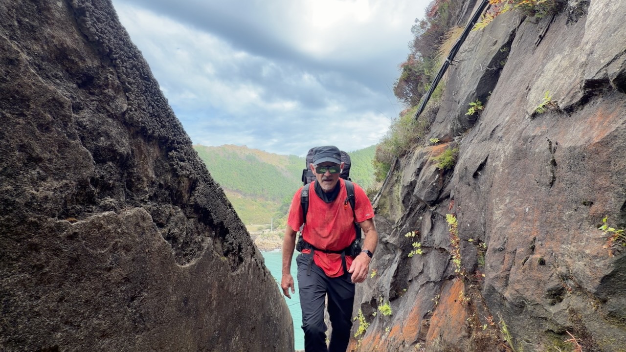
I skipped those โ€”ย instead hiking a narrow trail carved out of the rock cliff.

It’s a maximum of 9.2 km out and back. The first 2 km are relatively easy โ€” and that’s all I had time for.

Click PLAY or get a glimpse on YouTube.

Here’s the dam that created the lake.

This place is popular. On weekends you might have to park 15 minutes away.

Almost everyone signs up for a boat ride or kayak rental.

Almost everyone enjoys a drink in one of the restaurants.

I took off immediately on the FREE hike. And saw no more than a dozen others on a busy day โ€” and one dog.

It’s an interesting trail. Somebody decided to hang a kayak up on the cliffside.

Feel free to swim.


You can do this hike on your own. But it is included in many day tours out of Skopje. An easy way to get to the trailhead.

My tour included taking the cable car up to the Millennium Cross on Mount Vodno โ€”ย BUT the cable car had been closed for a number of months.

It also included a fascinating stop at the Church of St. Panteleimon. Highly recommended.

Great views back down to Skopje from up here.

Carnic Peace Trail, Austria

Also known as the Karnischer Hรถhenweg, (KHW 403) orย Via della Pace, the Carnic Peace Trail is isย a historic 150-kilometer (93-mile) long-distance hiking route following the former World War I frontline along the Austrian-Italian border.

It’s one of those European hut-to-hut only hikes, so buy the guidebook and book months in advance.

If you opt to do the entire thing, it 170km (106 miles) along the crest of the Carnic Alps, this dramatic high-level trail combines panoramic summits, wartime history and classic alpine hut-to-hut trekking across a landscape shaped by geology and conflict.

There are some challenging sections.

Click PLAY or watch it on YouTube.


Day Hike the Fisherman’s Trail, Portugal

For me, Stingy Nomads offer the most expert advice on Europe’s best coastal trail.

They recommend Porto Covo to Vila Nova de Milfontesย for those who want to walk just one day on the famed 230 km/143 mile Fishman’s Trail, just one part of the longer Rota Vicentinaย routes.

  • Distance โ€“ 19 km/11.8 mi
  • Time โ€“ 5h 10min.
  • Ascent โ€“ 278 m
  • Descent โ€“ 292 m
  • Difficulty level โ€“ 3 out of 5 it was a short walking day but most of the time you walk on dunes sometimes ankle-deepย in the sand.

Based on Stingy Nomads advice, I started in Porto Covo and hiked 4 days to Zambujeira do Mar.

If you have the time, take the ferry from Milfontes and keep heading south.

Here’s my TRIP REPORT & PHOTOS from 2021.

Click PLAY or watch it on YouTube.

Hiking Ladder of Kotor, Montenegro

Trip report by BestHike editor Rick McCharles.

The best hike directly from the tourist trap old city is Kotor Fortress.

But it costs 15 Euros (17.30 US) in 2026. They keep raising the price of this short day hike.

An alternative is Ladder of Kotor which goes higher. And is free.

Climb as high as you like. Return the same way โ€”ย or on other trails down. It’s a maze of trails.

I stopped once I reached the goats. ๐Ÿ˜€

It’s very hot in the summer. Because I was there end of August, I started as early in the morning as possible.

I had the old city to myself early morning.

Click PLAY or get a glimpse on YouTube.

Here’s the view over to the top of Kotor Fortress.

There are some ruins, as well. All open to exploration.

19th-century mountain pathย featuring roughly 70 hairpin switchbacks that climb from sea level up to the Krstac Pass.

Footing is not bad, but expect uneven, rocky switchbacks, loose gravel, and rugged limestone paths.

It’s a recommended short day hike.

Comparing the two main Kotor hikes.

Hiking Kotor Fortress, Montenegro

Trip report by BestHike editor Rick McCharles

The most popular hike directly from the old city of Kotor, Montenegro, is Kotor Fortress..

Evening View of Bay of Kotor old town from Lovcen mountain.
  • 4km out and back
  • 225m elevation gain
  • 1,350 stone steps or rough trail beside the steps

I mostly took the trail on the way up. The steps on the way down. With headlamp.

As it was 30+C and humid, I waited until 8pm to start up the stairs.

From 8pm to 9am Fortress is effectively free as there are no guards at the gate.

Locals are irked that the daytime charge is 15 Euros (17.30 US) in 2026. They keep raising the price of this short day hike.

I started in the old city, a World Heritage site.

Though you can see the climb, it’s still a bit of a challenge to find one of the two trailheads in the maze of narrow streets. I used AllTrails.

Quite quickly you get great views of the Bay.

There’s no need to climb to the top. In fact, I think most people stop at this lookout.

The trail gets rougher from that point. I carried on.

Here’s the top of theย San Giovanni Castleย ruins. I was hoping for moonrise โ€” but didn’t get it while up there.

Bats feed off insects attracted to the lights shining up the mountain. Those white blurs are bats in time exposure.


It would be quite a different experience climbing in the day time. Here’s how the fortress sits above, protecting the old city of Kotor.

Many start at 5 or 6 am, trying to get back before the ticket takers arrive in the morning.


There’s an alternative hike to get similar great vista views.

I did the Ladder of Kotor Trail, as well, next morning.

Hong Kong Four Trails Ultra Challenge

Hong Kong is perhaps the BEST major city for urban hikes.

But โ€”ย what if you try to run them continuously?

Hong Kong Four Trails Ultra Challengeย (Chinese:ย ้ฆ™ๆธฏๅ››ๅพ‘่ถ…็ดšๆŒ‘ๆˆฐ), orย HK4TUCย (Chinese:ย ๅ››ๅพ‘;ย lit.ย ‘Four Trails’), is an annualย ultramarathonย race inย Hong Kong. (Begun 2012.)

Considered one of the most challengingย mountain racesย worldwide, participants have to run through within 72 hours the famous quadruple hiking trails in Hong Kong known as “Four Trails”:ย MacLehose,ย Wilson,ย Hong Kong, andย Lantau.

The ultramarathon spans a total distance of 298 kilometres with a cumulative elevation of 14,500 metres …

Four Trailsย (Chinese:ย ้ฆ™ๆธฏๅ››ๅพ‘ๅคงๆญฅ่ตฐ) is a 2023ย Hong Kongย documentary filmย directed by Robin Lee.

As I post it’s available to watch free on Tubi.

Click PLAY or watch it on YouTube.

I’m Heading for Peaks of the Balkans Trail

BestHike editor Rick McCharles

I’m finally booked for Peaks of the Balkans starting Sept. 5, 2026.

In the Accursed Mountains, crossing between Albania, Kosovo, and Montenegro.

Originally I wanted to do it independently, like my hero Cam Honan.

A Quick & Dirty Guide to the Peaks of the Balkans Trail

The most traveled hiker in the world, even Cam had to hire local tour operator, Albanian-basedย Zbulo.org,ย to arrange their cross-border permits.

It sounded too complicated to me.

SO I signed on with a guided tour with TRAVELBASE.

5-day highlights of the longer circuit. Still crossing between Albania, Kosovo, and Montenegro. They call it Balkans Trail, a section of the Peaks of the Balkans.

I’ll carry my own pack. Sleep in my own tent. But enjoy meals provided by my Dutch guides.

Click PLAY or watch highlights on YouTube.

Morskie Oko Loop, Poland

A popular day hike is around Morskie Oko, the largest lake in the Polish Tatra Mountains. It is an easy trail, abundant in beautiful views and extremely varied.

AllTrails – Morskie Oko Loop

Getting to the lake is easy via a paved pathway. It’s about 9km return to the lake.

You don’t need your own vehicle as there are frequent private minibuses from the town of Zakopane. Getting to Zakopane from Krakรณw is 2-3 hours by bus or train.

Once at the lake, it’s another 3.9 km to add the shoreline loop walk. Unlike the smooth, paved access road you take to get to the lake, this loop is aย proper mountain trailย made of large, irregular stone blocks, boulders, and tree roots.

Click PLAY or watch it on YouTube.

Hiking Remote Hornstrandir, Iceland

Cam Honan posted his adventure on the Hornstrandir Peninsula – Icelandโ€™s most remote wilderness region.

Located in the rugged Westfjords, this pristine nature reserve has no roads, no permanent residents (at least of the bipedal variety), and is accessible only by boat during the summer.

While it may not be the easiest place to reach, those who make the journey are rewarded with a magical landscape of dramatic sea cliffs, lonely peaks, and primeval tundra.

The flora and fauna is equally impressive, with an exceptional variety of plant life, along with vast seabird colonies and an abundance of arctic foxes. Itโ€™s one of my favourite places in Icelandโ€”and considering the strength of the competition, thatโ€™s saying quite a bit!

Distance:  Approx. 120 km (75 mi) (including side trips)

Duration:  6 days

Difficulty Level:  Moderate

Check it out:

Hiking Hornstrandir: Into Icelandโ€™s Most Remote Wilderness


Samobor Castle Loop, Zagreb, Croatia

Trip report by BestHike editor Rick McCharles

I asked A.I. to recommend good day hiking close to Zagreb with easy access to public transit.

It sent me to Samobor, about 24km away. Less than an hour by frequent bus. Population about 38,000.

The most popular local day hike is Samobor Castle.

An evocative ruin.

By Miroslav.vajdic – Own work, CC BY-SA 4.0

Click PLAY or watch it on YouTube.

To get to the ruined fortress on the hill Tepec, I followed AllTrails Samobor Old Town.

  • 2.9km loop
  • 142m elevation gain

Trailhead right in the centre of town.

Easy walking on very well trod paths.

The ruins are still impressive. And wide open for exploration.

From the high point on that itinerary, you can continue upwards to Tepec Vista Point, a 14-meter-high steel pyramid tower.

It provides fantastic panoramic views over Samobor, Zagreb, and Medvednica Mountain.

Here’s the view back down on Samobor Castle.